Distance Calculator
Distance from Sines to Sintra
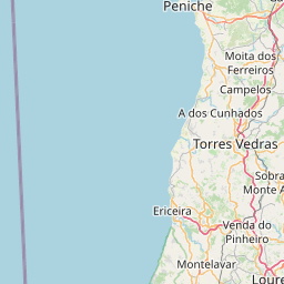
The shortest distance (air line) between Sines and Sintra is 64.88mi (104.42 km)
The shortest route between Sines and Sintra is 111.96 mi (180.19 km) according to the route planner. The driving time is approx. 2 h 16 m
How far is it between Sines and Sintra.
Sines is located in Alentejo Litoral, Portugalcountry within 37° 57' 16.92" N -9° 8' 8.16" W (37.9547, -8.8644) coordinates. The local time in Sines is 08:57 (07.07.2025)
Sintra is located in Area Metropolitana de Lisboa, Portugalcountry within 38° 47' 57.12" N -10° 36' 42.12" W (38.7992, -9.3883) coordinates. The local time in Sintra is 08:57 (07.07.2025)
The calculated flying distance from Sines to Sintra is 64.88miles which is equal to 104.42 km.
If you want to go by car, the driving driving distance between Sines and Sintra is 111.96 miles (180.19 km). If you ride your car with an average speef of 112 kilometers/hour (70 miles/h), travel time will be 1 hours 37 minutes.Please check the avg.speed travel time on the right for various options
Estimated Travel Time Between Sines and Sintra
| Average speed | Travel Time |
|---|---|
| 30 mph (48 km/h) | 3 hours 44 minutes |
| 40 mph (64 km/h) | 2 hours 48 minutes |
| 50 mph (80 km/h) | 2 hours 14 minutes |
| 60 mph (67 km/h) | 1 hours 52 minutes |
| 70 mph (112 km/h) | 1 hours 36 minutes |
| 75 mph (120 km/h) | 1 hours 30 minutes |
Sines, Alentejo Litoral, Portugal
Related Distances from Sines
| Cities | Distance |
|---|---|
| Sines to Setubal | 39.39 mi (63.38 km) |
| Sines to Almada | 52.60 mi (84.66 km) |
| Sines to Lisbon | 55.45 mi (89.23 km) |
| Sines to Oeiras | 55.99 mi (90.11 km) |
| Sines to Amadora | 57.39 mi (92.36 km) |
| Sines to Queluz | 59.20 mi (95.27 km) |
| Sines to Cascais | 59.56 mi (95.86 km) |
| Sines to Odivelas | 60.21 mi (96.89 km) |
| Sines to Loures | 62.87 mi (101.19 km) |
| Sines to Sintra | 64.88 mi (104.42 km) |
| Sines to Leiria | 124.09 mi (199.71 km) |
| Sines to Coimbra | 157.64 mi (253.70 km) |
| Sines to Viseu | 194.11 mi (312.38 km) |
| Sines to Vila Nova de Gaia | 220.02 mi (354.08 km) |
| Sines to Gondomar | 221.48 mi (356.43 km) |
| Sines to Porto | 221.99 mi (357.25 km) |
| Sines to Matosinhos | 223.25 mi (359.28 km) |
| Sines to Maia | 226.91 mi (365.18 km) |
| Sines to Famalicao | 239.91 mi (386.10 km) |
| Sines to Aves | 242.67 mi (390.54 km) |
| Sines to Guimaraes | 243.36 mi (391.64 km) |
| Sines to Barcelos | 246.46 mi (396.64 km) |
| Sines to Braga | 249.55 mi (401.61 km) |
| Sines to Viana do Castelo | 258.78 mi (416.47 km) |
| Sines to Funchal | 583.11 mi (938.43 km) |
Sintra, Area Metropolitana de Lisboa, Portugal
Related Distances to Sintra
| Cities | Distance |
|---|---|
| Cascais to Sintra | 7.02 mi (11.30 km) |
| Queluz to Sintra | 7.35 mi (11.83 km) |
| Oeiras to Sintra | 8.89 mi (14.31 km) |
| Amadora to Sintra | 9.51 mi (15.31 km) |
| Odivelas to Sintra | 11.25 mi (18.11 km) |
| Loures to Sintra | 12.16 mi (19.57 km) |
| Lisbon to Sintra | 13.82 mi (22.24 km) |
| Almada to Sintra | 14.87 mi (23.93 km) |
| Barreiro to Sintra | 19.60 mi (31.55 km) |
| Setubal to Sintra | 32.80 mi (52.79 km) |
| Leiria to Sintra | 72.84 mi (117.23 km) |
| Coimbra to Sintra | 110.14 mi (177.25 km) |
| Viseu to Sintra | 150.87 mi (242.80 km) |
| Vila Nova de Gaia to Sintra | 166.36 mi (267.74 km) |
| Porto to Sintra | 168.22 mi (270.73 km) |
| Gondomar to Sintra | 168.61 mi (271.36 km) |
| Matosinhos to Sintra | 168.70 mi (271.50 km) |
| Maia to Sintra | 173.06 mi (278.52 km) |
| Famalicao to Sintra | 186.62 mi (300.34 km) |
| Aves to Sintra | 191.30 mi (307.87 km) |
| Guimaraes to Sintra | 191.96 mi (308.93 km) |
| Barcelos to Sintra | 192.13 mi (309.20 km) |
| Braga to Sintra | 196.83 mi (316.77 km) |
| Viana do Castelo to Sintra | 202.55 mi (325.97 km) |
| Funchal to Sintra | 598.59 mi (963.34 km) |


