


Distance Calculator

Distance from Wuustwezel to Sint-Joost-ten-Node
The shortest distance (air line) between Wuustwezel and Sint-Joost-ten-Node is 38.03mi (61.20 km)
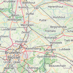
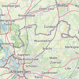
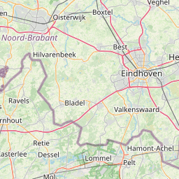
The shortest route between Wuustwezel and Sint-Joost-ten-Node is 49.78 mi (80.11 km) according to the route planner. The driving time is approx. 1 h 1 m
How far is it between Wuustwezel and Sint-Joost-ten-Node.
Wuustwezel is located in Arr. Antwerpen, Belgiumcountry within 51° 22' 59.88" N 4° 35' 60" E (51.3833, 4.6000) coordinates. The local time in Wuustwezel is 11:31 (06.07.2025)
Sint-Joost-ten-Node is located in Arr. de Bruxelles-Capitale/Arr. Brussel-Hoofdstad, Belgiumcountry within 50° 51' 0" N 4° 22' 59.88" E (50.8500, 4.3833) coordinates. The local time in Sint-Joost-ten-Node is 11:31 (06.07.2025)
The calculated flying distance from Wuustwezel to Sint-Joost-ten-Node is 38.03miles which is equal to 61.20 km.
If you want to go by car, the driving driving distance between Wuustwezel and Sint-Joost-ten-Node is 49.78 miles (80.11 km). If you ride your car with an average speef of 112 kilometers/hour (70 miles/h), travel time will be 0 hours 43 minutes.Please check the avg.speed travel time on the right for various options
Estimated Travel Time Between Wuustwezel and Sint-Joost-ten-Node
| Average speed | Travel Time |
|---|---|
| 30 mph (48 km/h) | 1 hours 40 minutes |
| 40 mph (64 km/h) | 1 hours 15 minutes |
| 50 mph (80 km/h) | 0 hours 60 minutes |
| 60 mph (67 km/h) | 0 hours 50 minutes |
| 70 mph (112 km/h) | 0 hours 43 minutes |
| 75 mph (120 km/h) | 0 hours 40 minutes |
Wuustwezel, Arr. Antwerpen, Belgium
Related Distances from Wuustwezel
Sint-Joost-ten-Node, Arr. de Bruxelles-Capitale/Arr. Brussel-Hoofdstad, Belgium
 Log in with Google