Distance Calculator

La Transeuropéenne, L'Occitane

246.5 km, 2 h 49 min

Head west on Rue du Pérou70 m
Turn left onto Rue Saint-Alyre35 m
Turn right onto Rue de la Garde50 m
Turn right onto Petite Rue de la Garde70 m
Continue slightly right onto Rue du Belloy200 m
Continue onto Rue Gilles Durant100 m
Make a slight left40 m
Go straight onto Boulevard Lavoisier (M 69)700 m
Turn right onto Avenue Raymond Bergougnan (M 941)700 m
Continue onto Avenue du Puy de Dôme (M 941)200 m
Keep right onto Avenue du Puy de Dôme (M 941)3 km
Go straight onto Route de la Baraque (D 941)1.5 km
Keep right onto Route de la Baraque (D 941)150 m
Continue slightly right onto Route de Limoges (D 941)2 km
Enter the traffic circle and take the 1st exit onto Route de Limoges (D 941)50 m
Exit the traffic circle onto Route de Limoges (D 941)5 km
Enter the traffic circle and take the 2nd exit towards A 89: A 8980 m
Exit the traffic circle towards A 89: A 893.5 km
Enter the traffic circle and take the 2nd exit onto D 94150 m
Exit the traffic circle onto D 9414 km
Enter the traffic circle and take the 2nd exit onto D 94145 m
Exit the traffic circle onto D 9414 km
Enter the traffic circle and take the 4th exit80 m
Exit the traffic circle1.5 km
Merge left onto La Transeuropéenne (A 89)150 km
Keep left towards A 20: Toulouse1 km
Merge left onto L'Occitane (A 20)15 km
Take the ramp towards A 89: Bordeaux300 m
Continue onto La Transeuropéenne60 km
Take the ramp700 m
Enter the traffic circle and take the 1st exit35 m
Exit the traffic circle500 m
Enter Giratoire de l'Autoroute and take the 2nd exit towards Périgueux25 m
Exit the traffic circle towards Périgueux800 m
Enter the traffic circle and take the 2nd exit towards Périgueux40 m
Exit the traffic circle towards Périgueux2 km
Enter the traffic circle and take the 2nd exit towards Périgueux55 m
Exit the traffic circle towards Périgueux1.5 km
Enter Giratoire Mémoire and take the 3rd exit towards Périgueux - centre-ville100 m
Exit the traffic circle towards Périgueux - centre-ville400 m
Enter the traffic circle and take the 1st exit onto Avenue François Mitterrand (D 6089)15 m
Exit the traffic circle onto Avenue François Mitterrand (D 6089)30 m
Go straight onto Avenue de la Fraternité (D 6089)200 m
Enter the traffic circle and take the 2nd exit onto Avenue François Mitterrand (D 6089)20 m
Exit the traffic circle onto Avenue François Mitterrand (D 6089)800 m
Keep left onto Avenue François Mitterrand (D 6089)60 m
Continue onto Route de Lyon (D 6089)1.5 km
Enter the traffic circle and take the 1st exit onto Cours Saint-Georges (D 6089)20 m
Exit the traffic circle onto Cours Saint-Georges (D 6089)400 m
Continue straight onto Cours Saint-Georges (D 6089)400 m
Continue onto Cours Fénelon (D 6089)400 m
Turn right onto Place Francheville (D 6089)100 m
Continue onto Place Bugeaud (D 939)150 m
Continue onto Boulevard Michel Montaigne (D 939)300 m
Enter Place Yves Guéna and take the 3rd exit onto Avenue Georges Pompidou (D 8)55 m
Exit the traffic circle onto Avenue Georges Pompidou (D 8)80 m
Turn left onto Rue Lamartine200 m
Turn right onto Rue Combe des Dames250 m
Make a slight right to stay on Rue Combe des Dames15 m
Make a slight left to stay on Rue Combe des Dames300 m
Turn left onto Rue Bellevue150 m
You have arrived at your destination, on the left0 m
From
    To

      Distance: 121.40 mi (195.37 km)

      Driving route: 153.19 mi (246.53 km).

      Driving time: 2h 48 min

      Distance from Perigueux to Clermont-Ferrand

      The shortest distance (air line) between Perigueux and Clermont-Ferrand is 121.40mi (195.37 km)

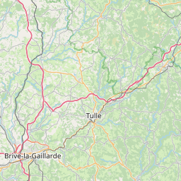
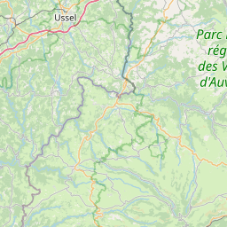
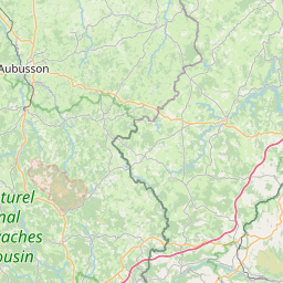
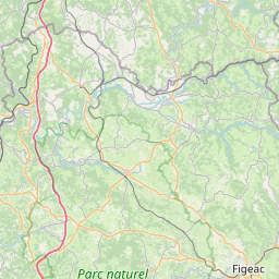
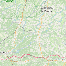
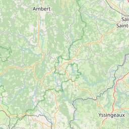
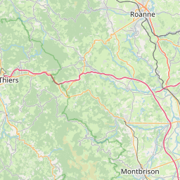
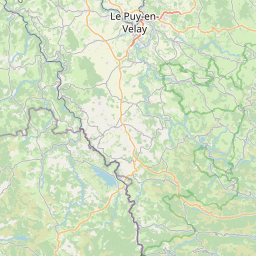
      The shortest route between Perigueux and Clermont-Ferrand is 153.19 mi (246.53 km) according to the route planner. The driving time is approx. 2 h 48 m

      How far is it between Perigueux and Clermont-Ferrand.

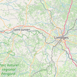
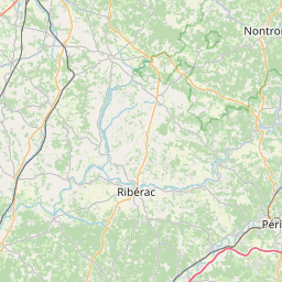
      Perigueux is located in Dordogne, Francecountry within 45° 11' 34.44" N 0° 43' 18.12" E (45.1929, 0.7217) coordinates. The local time in Perigueux is 07:17 (28.07.2025)

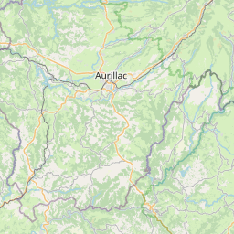
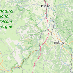
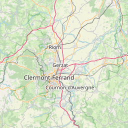
      Clermont-Ferrand is located in Puy-de-Dome, Francecountry within 45° 46' 59.16" N 3° 4' 56.64" E (45.7831, 3.0824) coordinates. The local time in Clermont-Ferrand is 07:17 (28.07.2025)

      The calculated flying distance from Perigueux to Clermont-Ferrand is 121.40miles which is equal to 195.37 km.

      If you want to go by car, the driving driving distance between Perigueux and Clermont-Ferrand is 153.19 miles (246.53 km). If you ride your car with an average speef of 112 kilometers/hour (70 miles/h), travel time will be 2 hours 12 minutes.Please check the avg.speed travel time on the right for various options

      Estimated Travel Time Between Perigueux and Clermont-Ferrand

      Average speedTravel Time
      30 mph (48 km/h)5 hours 6 minutes
      40 mph (64 km/h)3 hours 50 minutes
      50 mph (80 km/h)3 hours 4 minutes
      60 mph (67 km/h)2 hours 33 minutes
      70 mph (112 km/h)2 hours 11 minutes
      75 mph (120 km/h)2 hours 3 minutes

      Perigueux, Dordogne, France

      Related Distances from Perigueux

      CitiesDistance
      Perigueux to Bordeaux68.09 mi (109.58 km)
      Perigueux to Toulouse115.39 mi (185.71 km)
      Perigueux to Clermont-Ferrand121.40 mi (195.37 km)
      Perigueux to Angers168.92 mi (271.85 km)
      Perigueux to Nantes177.21 mi (285.19 km)
      Perigueux to Saint-Etienne179.02 mi (288.10 km)
      Perigueux to Montpellier190.23 mi (306.14 km)
      Perigueux to Le Mans196.06 mi (315.53 km)
      Perigueux to Nimes202.24 mi (325.47 km)
      Perigueux to Lyon203.31 mi (327.20 km)
      Perigueux to Villeurbanne205.30 mi (330.40 km)
      Perigueux to Rennes231.75 mi (372.97 km)
      Perigueux to Grenoble243.50 mi (391.88 km)
      Perigueux to Dijon252.20 mi (405.88 km)
      Perigueux to Aix-en-Provence260.16 mi (418.68 km)
      Perigueux to Boulogne-Billancourt261.62 mi (421.04 km)
      Perigueux to Paris264.52 mi (425.70 km)
      Perigueux to Marseille264.71 mi (426.01 km)
      Perigueux to Toulon294.98 mi (474.72 km)
      Perigueux to Le Havre298.32 mi (480.10 km)
      Perigueux to Reims321.23 mi (516.97 km)
      Perigueux to Brest330.89 mi (532.51 km)
      Perigueux to Nice338.70 mi (545.09 km)
      Perigueux to Lille390.74 mi (628.84 km)
      Perigueux to Strasbourg405.80 mi (653.07 km)

      Clermont-Ferrand, Puy-de-Dome, France

      Related Distances to Clermont-Ferrand

      CitiesDistance
      Saint-Etienne to Clermont-Ferrand67.64 mi (108.86 km)
      Lyon to Clermont-Ferrand84.72 mi (136.34 km)
      Villeurbanne to Clermont-Ferrand86.65 mi (139.45 km)
      Grenoble to Clermont-Ferrand134.69 mi (216.77 km)
      Dijon to Clermont-Ferrand140.26 mi (225.73 km)
      Nimes to Clermont-Ferrand148.28 mi (238.64 km)
      Montpellier to Clermont-Ferrand155.01 mi (249.46 km)
      Tours to Clermont-Ferrand159.03 mi (255.94 km)
      Toulouse to Clermont-Ferrand170.68 mi (274.68 km)
      Bordeaux to Clermont-Ferrand189.49 mi (304.95 km)
      Aix-en-Provence to Clermont-Ferrand194.41 mi (312.87 km)
      Le Mans to Clermont-Ferrand205.31 mi (330.42 km)
      Marseille to Clermont-Ferrand205.43 mi (330.61 km)
      Angers to Clermont-Ferrand208.33 mi (335.28 km)
      Boulogne-Billancourt to Clermont-Ferrand214.53 mi (345.25 km)
      Paris to Clermont-Ferrand215.10 mi (346.17 km)
      Toulon to Clermont-Ferrand231.14 mi (371.98 km)
      Nantes to Clermont-Ferrand241.67 mi (388.93 km)
      Reims to Clermont-Ferrand244.49 mi (393.47 km)
      Nice to Clermont-Ferrand250.56 mi (403.23 km)
      Rennes to Clermont-Ferrand276.32 mi (444.69 km)
      Le Havre to Clermont-Ferrand291.28 mi (468.77 km)
      Strasbourg to Clermont-Ferrand292.12 mi (470.12 km)
      Lille to Clermont-Ferrand334.74 mi (538.71 km)
      Brest to Clermont-Ferrand398.94 mi (642.04 km)