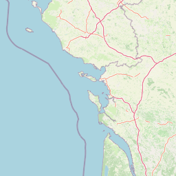
| Head north on Rue d'Antrain | 30 m |
| Turn left onto Contour Saint-Aubin | 150 m |
| Continue slightly right onto Rue de Saint-Malo | 200 m |
| Turn right onto Rue de l'Hôtel Dieu | 250 m |
| Continue onto Rue Lesage | 300 m |
| Continue onto Boulevard de Sévigné | 1 km |
| Turn right onto Boulevard de Metz | 200 m |
| Continue onto Boulevard de Strasbourg | 500 m |
| Continue onto Boulevard Villebois-Mareuil | 900 m |
| Enter the traffic circle and take the 2nd exit onto Boulevard Villebois-Mareuil | 30 m |
| Exit the traffic circle onto Boulevard Villebois-Mareuil | 400 m |
| Continue onto Boulevard Léon Bourgeois | 250 m |
| Turn left onto Rue Martin-Feuillée | 250 m |
| Turn left onto Rue de Vern | 1.5 km |
| Enter the traffic circle and take the 2nd exit onto Rue de Vern | 60 m |
| Exit the traffic circle onto Rue de Vern | 150 m |
| Enter the traffic circle and take the 1st exit onto Rue de Vern | 10 m |
| Exit the traffic circle onto Rue de Vern | 200 m |
| Enter Porte du Blosne and take the 2nd exit onto Porte d'Angers (D 173) | 45 m |
| Exit the traffic circle onto Porte d'Angers (D 173) | 300 m |
| Enter the traffic circle and take the 2nd exit onto Route d'Angers (D 173) | 100 m |
| Exit the traffic circle onto Route d'Angers (D 173) | 700 m |
| Enter the traffic circle and take the 2nd exit onto Route d'Angers (D 173) | 80 m |
| Exit the traffic circle onto Route d'Angers (D 173) | 3.5 km |
| Enter Rond-Point de la Croix Rouge and take the 2nd exit onto Route d'Angers (D 173) | 80 m |
| Exit the traffic circle onto Route d'Angers (D 173) | 500 m |
| Enter Rond-Point du Pâtis Fraux and take the 3rd exit onto Route d'Angers (D 173) | 80 m |
| Exit the traffic circle onto Route d'Angers (D 173) | 45 km |
| Continue onto D 775 | 3.5 km |
| Enter Rond-Point de Rennes and take the 2nd exit onto D 775 | 50 m |
| Exit the traffic circle onto D 775 | 4 km |
| Enter Rond-Point de Laval and take the 2nd exit onto D 775 | 70 m |
| Exit the traffic circle onto D 775 | 20 km |
| Enter the traffic circle and take the 3rd exit onto D 775 | 80 m |
| Exit the traffic circle onto D 775 | 5.5 km |
| Continue onto D 775 | 400 m |
| Enter the traffic circle and take the 2nd exit onto Rocade Nord-Est (D 775) | 80 m |
| Exit the traffic circle onto Rocade Nord-Est (D 775) | 1.5 km |
| Enter Rond-Point de l'Europe and take the 4th exit onto D 775 | 150 m |
| Exit the traffic circle onto D 775 | 10 km |
| Enter Giratoire de la Roche aux Fées and take the 2nd exit towards Angers | 35 m |
| Exit the traffic circle towards Angers | 1.5 km |
| Enter Giratoire de Durval and take the 4th exit towards Angers | 90 m |
| Exit the traffic circle towards Angers | 1.5 km |
| Enter Giratoire de la Grée and take the 2nd exit towards Angers | 60 m |
| Exit the traffic circle towards Angers | 6 km |
| Enter Giratoire de Pruillé and take the 2nd exit towards Angers | 35 m |
| Exit the traffic circle towards Angers | 10 km |
| Continue onto D 323 | 6 km |
| Take the ramp towards La Roseraie | 450 m |
| Merge left onto Boulevard Charles Barangé | 1 km |
| Continue onto Boulevard Abbé Édouard Chauvat | 200 m |
| Continue onto Boulevard Jacques Portet | 600 m |
| Enter Avenue Winston Churchill and take the 1st exit onto Boulevard Eugène Chaumin | 35 m |
| Exit the traffic circle onto Boulevard Eugène Chaumin | 400 m |
| Continue onto Boulevard Joseph Bédier | 900 m |
| Exit the traffic circle onto Avenue de Lattre de Tassigny | 450 m |
| Enter Rond-Point du Courrier de l'Ouest and take the 3rd exit onto Avenue de Lattre de Tassigny (D 260) | 55 m |
| Exit the traffic circle onto Avenue de Lattre de Tassigny (D 260) | 300 m |
| Continue onto D 160 | 150 m |
| Enter the traffic circle and take the 3rd exit onto D 260 | 80 m |
| Exit the traffic circle onto D 260 | 2 km |
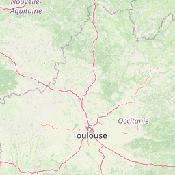
| Merge left onto A 87N | 4.5 km |
| Take the ramp towards 22: Poitiers | 350 m |
| Keep right towards Juigné-sur-Loire | 200 m |
| Enter Rond-Point du Champ du Poirier and take the 3rd exit towards Niort | 90 m |
| Exit the traffic circle towards Niort | 9 km |
| Enter the traffic circle and take the 3rd exit towards Poitiers | 100 m |
| Exit the traffic circle towards Poitiers | 20 km |
| Enter the traffic circle and take the 2nd exit towards Saumur | 90 m |
| Exit the traffic circle towards Saumur | 3.5 km |
| Enter the traffic circle and take the 3rd exit towards Saumur | 100 m |
| Exit the traffic circle towards Saumur | 4.5 km |
| Enter the traffic circle and take the 1st exit towards Niort | 25 m |
| Exit the traffic circle towards Niort | 8 km |
| Enter the traffic circle and take the 1st exit onto D 347 | 7 m |
| Exit the traffic circle onto D 347 | 2.5 km |
| Enter the traffic circle and take the 2nd exit onto D 347 | 55 m |
| Exit the traffic circle onto D 347 | 2 km |
| Enter the traffic circle and take the 2nd exit onto D 347 | 40 m |
| Exit the traffic circle onto D 347 | 20 km |
| Enter the traffic circle and take the 3rd exit onto D 347 | 55 m |
| Exit the traffic circle onto D 347 | 2 km |
| Enter Rond-Point de Poitiers and take the 1st exit onto Route de Poitiers (D 347) | 55 m |
| Exit the traffic circle onto Route de Poitiers (D 347) | 25 km |
| Enter the traffic circle and take the 1st exit onto D 347 | 30 m |
| Exit the traffic circle onto D 347 | 1.5 km |
| Enter Carrefour and take the 2nd exit onto Boulevard Fouquet Nerra (D 347) | 40 m |
| Exit the traffic circle onto Boulevard Fouquet Nerra (D 347) | 1.5 km |
| Continue onto Route de Poitiers (D 347) | 8 km |
| Enter the traffic circle and take the 3rd exit onto D 347 | 100 m |
| Exit the traffic circle onto D 347 | 3.5 km |
| Enter the traffic circle and take the 2nd exit onto D 347 | 45 m |
| Exit the traffic circle onto D 347 | 1.5 km |
| Enter Rond-Point Charles de Gaulle and take the 3rd exit onto Rue | 80 m |
| Exit the traffic circle onto Rue | 35 m |
| Continue slightly right onto Avenue de Saumur | 700 m |
| Enter the traffic circle and take the 2nd exit onto Avenue de Saumur | 40 m |
| Exit the traffic circle onto Avenue de Saumur | 50 m |
| Go straight onto D 347 | 3 km |
| Enter the traffic circle and take the 2nd exit onto D 347 | 50 m |
| Exit the traffic circle onto D 347 | 1 km |
| Enter the traffic circle and take the 2nd exit onto N 147 | 40 m |
| Exit the traffic circle onto N 147 | 15 km |
| Enter the traffic circle and take the 2nd exit onto N 147 | 70 m |
| Exit the traffic circle onto N 147 | 7 km |
| Enter the traffic circle and take the 2nd exit onto N 147 | 45 m |
| Exit the traffic circle onto N 147 | 9 km |
| Enter the traffic circle and take the 2nd exit onto N 147 | 45 m |
| Exit the traffic circle onto N 147 | 7 km |
| Enter the traffic circle and take the 2nd exit onto N 147 | 45 m |
| Exit the traffic circle onto N 147 | 9 km |
| Enter the traffic circle and take the 1st exit onto N 147 | 55 m |
| Exit the traffic circle onto N 147 | 15 km |
| Enter the traffic circle and take the 2nd exit onto Rue Nationale (N 147) | 70 m |
| Exit the traffic circle onto Rue Nationale (N 147) | 20 km |
| Enter the traffic circle and take the 3rd exit onto Route de Poitiers (D 947) | 80 m |
| Exit the traffic circle onto Route de Poitiers (D 947) | 3 km |
| Keep right onto Route de Poitiers (D 947) | 100 m |
| Make a slight right onto D 675 | 3 km |
| Continue onto D 675 | 25 km |
| Enter the traffic circle and take the 2nd exit onto D 675 | 60 m |
| Exit the traffic circle onto D 675 | 350 m |
| Enter the traffic circle and take the 1st exit towards D 941: Rochechouart | 35 m |
| Exit the traffic circle towards D 941: Rochechouart | 900 m |
| Enter the traffic circle and take the 2nd exit towards D 941: Rochechouart | 30 m |
| Exit the traffic circle towards D 941: Rochechouart | 350 m |
| Continue straight onto Avenue d'Oradour-sur-Glane (D 941) | 450 m |
| Continue onto Avenue Henri Barbusse (D 941) | 600 m |
| Enter the traffic circle and take the 1st exit towards D 941: Rochechouart | 15 m |
| Exit the traffic circle towards D 941: Rochechouart | 200 m |
| Enter the traffic circle and take the 2nd exit towards D 941: Angoulême | 40 m |
| Exit the traffic circle towards D 941: Angoulême | 350 m |
| Enter the traffic circle and take the 4th exit onto Boulevard de la République | 50 m |
| Exit the traffic circle onto Boulevard de la République | 100 m |
| Turn right onto Avenue Gustave Flaubert | 500 m |
| Turn left onto Avenue Victor Roche (D 675) | 550 m |
| Continue onto Route de Rochechouart (D 675) | 100 m |
| Turn left onto Côte du Maluchat (C 37) | 700 m |
| Continue onto Route du Bois au Boeuf (C 37) | 900 m |
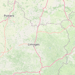
| Turn left onto Route de Saint-Laurent (D 21) | 10 km |
| Continue onto Rue des Scieurs de Long (D 21) | 400 m |
| Continue onto Les Landes de Lascaux (D 21) | 1.5 km |
| Continue onto Route de Limont (D 21) | 450 m |
| Continue onto Avenue du 8 Mai 1945 (D 21) | 900 m |
| Turn left onto Place Weihenzel (D 34) | 60 m |
| Turn left onto Place de la Mairie | 50 m |
| Continue onto Avenue Jean Jaurès | 350 m |
| Turn left onto Avenue Charles de Gaulle (D 34) | 10 m |
| Turn right onto Rue Victor Hugo (D 21) | 3.5 km |
| Continue onto Rue Louise Michel (D 699) | 350 m |
| Turn right onto D 21 | 4.5 km |
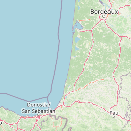
| Turn right onto N 21 | 35 km |
| Enter the traffic circle and take the 2nd exit onto Avenue Roger Jaccou (N 21) | 35 m |
| Exit the traffic circle onto Avenue Roger Jaccou (N 21) | 2 km |
| Continue onto Route de Gavarnie (N 21) | 7 km |
| Keep right onto N 21 | 4 km |
| Turn right onto Avenue de la Voie Romaine (D 8) | 6 km |
| Continue onto Avenue de la Résistance (D 8) | 2 km |
| Continue onto Rue Valentine Bussière (D 8) | 900 m |
| Continue onto Route des Piles (D 8) | 5.5 km |
| Continue onto Route de Paris (D 8) | 800 m |
| Enter the traffic circle and take the 2nd exit onto Route de Paris (D 8) | 30 m |
| Exit the traffic circle onto Route de Paris (D 8) | 1 km |
| Enter the traffic circle and take the 1st exit onto Route de Paris (D 8) | 25 m |
| Exit the traffic circle onto Route de Paris (D 8) | 700 m |
| Enter the traffic circle and take the 1st exit onto Avenue Georges Pompidou (D 8) | 35 m |
| Exit the traffic circle onto Avenue Georges Pompidou (D 8) | 1 km |
| Enter the traffic circle and take the 1st exit onto Avenue Georges Pompidou (D 8) | 10 m |
| Exit the traffic circle onto Avenue Georges Pompidou (D 8) | 35 m |
| Turn right onto Rue des Acacias | 250 m |
| Turn left onto Rue des Remparts | 500 m |
| Turn right onto Rue Combe des Dames | 300 m |
| Turn left onto Rue Bellevue | 150 m |
| You have arrived at your destination, on the left | 0 m |


 Log in with Google